We find things no one else can find.
 

YOUR GEOINT EXPERTS

Our team functions seamlessly as an extension of yours.

Darkhorse Geospatial specializes in geospatial services, products, maps, FMV, ISR, and Maritime and Wildland Fire data analysis. As a small, nimble firm, we are easy to work with, placing our focus on quality over quantity. We partner with government entities to bring clear, spatially-driven insights to vast and multilayered datasets in the geospatial intelligence space.

 
geospatial-services.jpeg
 

The Team

We work collaboratively with specialized geospatial expertise and intuitive understanding — asking better questions and interpreting complex data to communicate stories that matter.


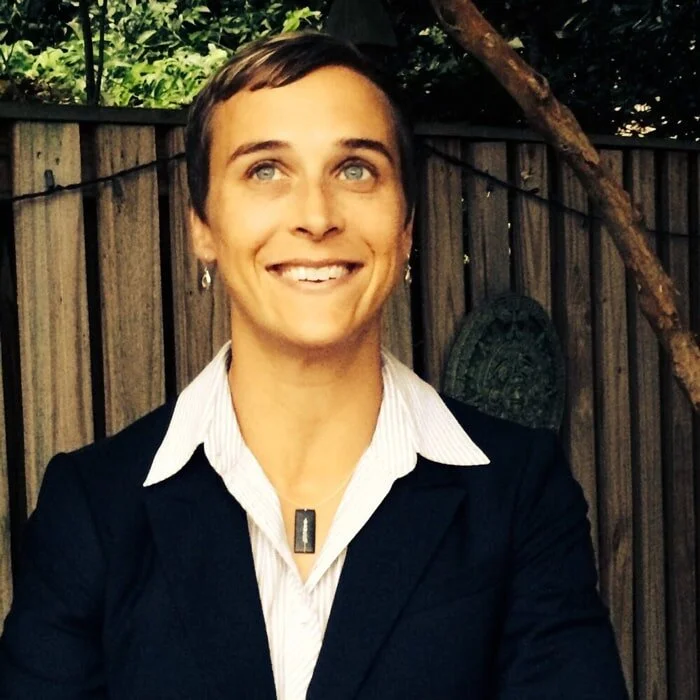
Emmy

Cofounder/owner

As the cofounder of Darkhorse Geospatial, Emmy Harbo draws from over 15 years of collaboration and leadership in Geospatial IT and GIS projects. She oversees federal government business development efforts, mission-focused projects, and private initiatives, with a proven track record for intuitive data translation and effective problem-solving.

Read More

Emmy is known for her successful introduction and implementation of innovative IT concepts in wildlife fire analysis and management, shifting how the community and general public understand and mitigate fire. Certified in geospatial analysis and link analysis tools, she fulfills diverse roles as both senior analyst and project manager. Emmy first experienced the dynamic applications of GIS, imagery analysis, and GPS while working as an archaeologist, locating prehistoric human habitations on San Clemente Island off the coast of California. Enthralled by the possibilities, she pivoted to pursue a career in geospatial technology. When the tragedy of 9/11 rocked the nation, she was motivated to support the American intelligence community in vital global missions fighting the war on terror.

Emmy is highly inquisitive and determined, taking pride in rising to each new challenge and developing new ways of seeing the world around us. When not exploring spatial relationships through advanced tech, she enjoys exploring the natural world on her own two feet, hiking in Idaho’s rugged, beautiful Sawtooth Mountains. Raised in Baton Rouge, Louisiana, she traveled across the country and Europe to play competitive soccer at the Division 1 and Semi-Pro levels. “I learned to work together with a variety of personality types in pursuit of a common goal — and when to lead, when to follow, and when to get out of the way!”

Emmy is a contracted seasonal employee of the Bureau of Land Management (BLM) Boise Dispatch. Each summer she is dispatched to fight fires as a Communication Technician (COMT). In this role she enjoys many helicopter rides and strenuous hikes to place communication equipment on mountain tops to facilitate incident communication.

darkhorse-geospatial-emmy-harbo.jpeg


Maureen

Cofounder/owner

Maureen spent her formative years in Saudi Arabia, roller skating, swimming, and listening to disco with her international friends. By the time she was 13 years old, she'd been to 35 different countries with her parents and three siblings. She still remembers vividly when during an African safari, their family’s truck got stuck and she lost one of her little red shoes in the mud. She never found that shoe, but she has been looking for things ever since.

Read More

Maureen once found 100 Swiss Francs in Switzerland and bought herself and her siblings so much white Swiss chocolate that they all got sick. She’s spotted a grizzly bear walking just 100 feet from her car in Yellowstone National Park. And in 2020, she found the biggest morel mushroom patch any of her fellow foragers had ever seen.

Certified in ArcGIS and link analysis tools, Maureen loves searching for things in her professional career, where nothing gets by her. She cofounded Darkhorse Geospatial, where she crunches numbers for breakfast. Maureen still loves disco and enjoys hiking, gardening, woodworking, and baking. To this day she prefers milk or dark chocolate over white.

darkhorse-geospatial-maureen-fallon.jpeg
 

Philosophy

Humans interact and thrive wholly in relation to our surrounding environments.

Geospatial thinking allows us to make informed, strategic decisions through an elevated understanding of spatial relationships. 

The vastness of datasets adds both complexity and clarity to mission-focused, evolving challenges. The key is seeing geospatial data as a language — asking the right questions at the right times, in order to bring the best possible solutions to light.

Our data science combines scientific analysis with storytelling, interpreting what we see to empower more ah-ha moments.

 
geoint-services.jpeg
 

Intuition, experience, and diverse perspectives.

Darkhorse Geospatial is a certified woman-owned firm. Our collaborative approach to geospatial data intelligence supports public work at all scales.


CONTRACTS

 
  • NGA Multi Intelligence Analytical & Collection Support Services (MACSS) Large Business and Small Business Set-aside

  • Department of Interior (DOI) Office of Wildland Fire (OWF) IRWIN Support

  • NGA Janus Geography

  • DOI National Park Service (NPS) Wildland Fire Program GIS Support Services

  • Defense Intelligence Agency (DIA) SITE III

  • Certified Pacific North West Coordinating Group (PNWCG) Records Inspector for Wildland Fire Positions


Work With Darkhorse

Join our Team

Darkhorse Geospatial is a small, dedicated firm with an innovative approach to geospatial intelligence. Our growing team of talented individuals works tirelessly to solve complex problems in a variety of industries and disciplines.

 
geospatial-services.jpeg